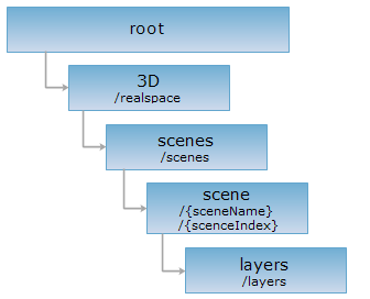
<scene_uri>/layers[.<format>]
The layers resource represents a set of 3D layers in a 3D scene. It can be used to retrieve a list of 3D layers in the current 3D scene.
Supported methods
Supported output formats: RJSONJSON, JSONP, HTML, XML.
Below is an example of performing an HTTP request on a URI with rjson as the output format
http://supermapiserver:8090/iserver/services/3D-sample/rest/realspace/scenes/scene/layers.rjson
Gets a list of 3D layers in the current 3D scene.
| Field | Type | Definition |
| _cache | boolean | [Optional parameters] Whether to use cache, the default is True. False means close all the cache. |
Performing a GET request on the layers resource returns a response describing a set of 3D layers. The description of each individual layer has the following structure:
| Name | Type | Description |
| alwaysRender | boolean | Whether to always render the layer. |
| bounds | Rectangle2D | The bounds of the layer. |
| cachePassword | String | The password for the 3D layer. |
| caption | String | The caption of the layer. It is the same with the layer name by default. But the user can modify it according to their needs. |
| dataConfigPath | String | The path of the data used in the 3D layer. |
| dataName | String | The name of the 3D layer. |
| description | String | The descriptive information about the layer. |
| editable | boolean | Whether the layer is editable. |
| hasLocalCache | boolean | Marks whether the 3D cached tiles aref saved locally. |
| layer3DType | Layer3DType | The layer type. |
| level | int | The cache level. |
| maxVisibleAltitude | double | The maximum visible altitude. |
| minVisibleAltitude | double | The minimum visible altitude. |
| name | String | The name of the layer. This serves as the unique identification of the layer in a map. Case sensitive. |
| oldCache | boolean | Whether to use old cache. |
| queryable | boolean | Whether the objects in the layer can be queried. |
| style | String | The rendering style of the layer. |
| subLayers | String | Information on the sub-layers. |
| visible | boolean | Whether the layer is visible. |
| visibleDistance | double | The visible distance from an object in the 3D layer. |
Below is the returned representation in rjson format after a GET request is performed on an example layers resource (a set of 3D layers in a 3D scene):
[
{
"alwaysRender": true,
"bounds": null,
"cachePassword": null,
"caption": "Tree@CBD",
"dataConfigPath": "C:/SuperMap/SuperMapiServer/samples/data/Realspace/CBD/Tree@CBD/Tree@CBD.scp",
"dataName": "Tree@CBD",
"description": "",
"editable": false,
"hasLocalCache": true,
"isWebDatasource": false,
"layer3DType": "OSGBLayer",
"level": -1,
"maxVisibleAltitude": 0,
"minVisibleAltitude": 0,
"name": "Tree@CBD",
"oldCache": false,
"queryable": false,
"subLayers": {},
"type": null,
"useTwoDimenCache": false,
"visible": true,
"visibleDistance": 0
},
{
"alwaysRender": true,
"bounds": null,
"cachePassword": null,
"caption": "Lake@CBD",
"dataConfigPath": "C:/SuperMap/SuperMapiServer/samples/data/Realspace/CBD/Lake@CBD/Lake@CBD.scp",
"dataName": "Lake@CBD",
"description": "",
"editable": false,
"hasLocalCache": true,
"isWebDatasource": false,
"layer3DType": "OSGBLayer",
"level": -1,
"maxVisibleAltitude": 0,
"minVisibleAltitude": 0,
"name": "Lake@CBD",
"oldCache": false,
"queryable": false,
"subLayers": {},
"type": null,
"useTwoDimenCache": false,
"visible": true,
"visibleDistance": 0
},
{
"alwaysRender": true,
"bounds": null,
"cachePassword": null,
"caption": "Ground_2@CBD",
"dataConfigPath":"C:/SuperMap/SuperMapiServer/samples/data/Realspace/CBD/Ground_2@CBD/Ground_2@CBD.scp",
"dataName": "Ground_2@CBD",
"description": "",
"editable": false,
"hasLocalCache": true,
"isWebDatasource": false,
"layer3DType": "OSGBLayer",
"level": -1,
"maxVisibleAltitude": 0,
"minVisibleAltitude": 0,
"name": "Ground_2@CBD",
"oldCache": false,
"queryable": false,
"subLayers": {},
"type": null,
"useTwoDimenCache": false,
"visible": true,
"visibleDistance": 0
},
{
"alwaysRender": true,
"bounds": null,
"cachePassword": null,
"caption": "Ground_1@CBD",
"dataConfigPath":"C:/SuperMap/SuperMapiServer/samples/data/Realspace/CBD/Ground_1@CBD/Ground_1@CBD.scp",
"dataName": "Ground_1@CBD",
"description": "",
"editable": false,
"hasLocalCache": true,
"isWebDatasource": false,
"layer3DType": "OSGBLayer",
"level": -1,
"maxVisibleAltitude": 0,
"minVisibleAltitude": 0,
"name": "Ground_1@CBD",
"oldCache": false,
"queryable": false,
"subLayers": {},
"type": null,
"useTwoDimenCache": false,
"visible": true,
"visibleDistance": 0
},
{
"alwaysRender": true,
"bounds": null,
"cachePassword": null,
"caption": "Building@CBD",
"dataConfigPath":"C:/SuperMap/SuperMapiServer/samples/data/Realspace/CBD/Building@CBD/Building@CBD.scp",
"dataName": "Building@CBD",
"description": "",
"editable": false,
"hasLocalCache": true,
"isWebDatasource": false,
"layer3DType": "OSGBLayer",
"level": -1,
"maxVisibleAltitude": 0,
"minVisibleAltitude": 0,
"name": "Building@CBD",
"oldCache": false,
"queryable": false,
"subLayers": {},
"type": null,
"useTwoDimenCache": false,
"visible": true,
"visibleDistance": 0
}
]
Asks for the response identical to the one that would correspond to a GET request, but without the response body. This is useful for retrieving meta-information written in response headers, without having to transport the entire content. The meta-information includes the media-type, content-encoding, transfer-encoding, content-length, etc.
HEAD request can be used to check if the layers resource exists, or if the resource can be accessed by clients. It can also determine if the layers resource supports an output format <format> if performed on a URI with .<format> included.