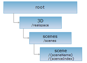
<scenes_uri>/{sceneName}[.<format>]
<scenes_uri>/{sceneIndex}[.<format>]
The scene resource represents a specific 3D scene. The major component of a 3D scene is a 3D globe simulating the shape of the Earth. Information about the atmosphere, the camera, the fog, the 3D data layers, etc., is then displayed on the 3D globe to approximate the reality. You can access a scene through {sceneName} or {sceneIndex}, with {sceneName} having higher priority than {sceneIndex}.
The XML representation of this resource is the standard description of Scene generated from SuperMap Objects Java. The clients of 3D service can read this XML file for rendering a 3D scene.
Implementing the GET request on the scene resource can retrieve the 3D representation, which displays the 3D scene at the client of a 3D service, showing a 3D globe with all the layers in the 3D scene added onto it.
Supported methods:
Supported output formats: RJSON, JSON, JSONP, HTML, XML, 3D.
Below is an example of performing an HTTP request on a URI with rjson as the output format. supermapiserver in the URI is the name of the server.
http://supermapiserver:8090/iserver/services/3D-sample/rest/realspace/scenes/scene.rjson
Gets the description of a 3D scene.
None.
After a GET request is performed on the scene resource, a resource representation is returned (except for the representation in xml format) with the following structure (the resource representation is included in the entity body of the response message):
Note: The structure of representation in xml output format is different from the other output formats in order to easily convert the xml representation to a scene object in SuperMap. But the content of an xml representation is the same as in the other output formats.
| Field | Type | Description |
| atmosphere | Atmosphere | The atmosphere environment. |
| camera | Camera | The camera of the current 3D scene, serving as the view point. |
| cameraFOV | double | The FOV (field of view) of the camera. The unit is degree, and the range is 0-90 degrees. The default value is 45. |
| fog | Fog | The fog object in the current 3D scene. Objects such as Fog and Lights in a scene are for rendering effects. |
| fogVisibleAltitude | double | The visible altitude (the elevation distance above the sea level on the Earth surface) in the 3D scene given the fog condition. |
| latLonGrid | LatLonGrid | The settings of the latitude and longitude grid for the current 3D scene. It is used to set up the latitude and longitude grid for the current scene and indicate if the text in the grid is visible. |
| layers | Layer3Ds | A set of 3D layers. |
| maxCameraDistance | double | The maximum camera distance in meter. |
| minCameraDistance | double | The minimum camera distance in meter. |
| name | String | The name of the current 3D scene. |
| scaleLegendVisible | boolean | Whether the scale legend is visible. "True" indicates the scale legend is visible, while "False" indicates it is not. |
| screenLayer | ScreenLayer | The screen layer of the current 3D scene. A 3D scene must have one and only one screen layer. Any 3D geometric objects can be added to the screen layer. The added geometric objects do not change as the sphere in the 3D scene rotates, tilts, etc., i.e., the objects in the screen layer are still relative to the 3D window. Therefore the screen layer can be used to display any content that should be still in the window. |
| terrainExaggeration | double | The scale of terrain exaggeration. |
| trackingLayer | TrackingLayer3D | The 3D tracking layer. |
Performing a GET request on the example scene resource returns the following representation in rjson format:
{
"atmosphere": {"visible": true},
"camera": {
"altitude": 510.15876223985106,
"altitudeMode": "RELATIVE_TO_GROUND",
"empty": false,
"heading": 359.9998737040828,
"latitude": 39.99375298399387,
"longitude": 116.38343383513059,
"tilt": 71.565051177178
},
"cameraFOV": 60.00000000019494,
"fog": {
"color": {
"blue": 255,
"green": 255,
"red": 255
},
"density": 1,
"enable": false,
"endDistance": 1,
"mode": "EXP",
"startDistance": 0
},
"fogVisibleAltitude": 20000,
"latLonGrid": {
"textVisible": true,
"visible": false
},
"layers": [
{
"alwaysRender": true,
"bounds": null,
"cachePassword": "",
"caption": "OlympicGreen",
"dataConfigPath": "C:/SuperMap/SuperMapiServerJava6R/samples/data/Realspace/olympicgreen/OlympicGreen.scv",
"dataName": "OlympicGreen_705273881",
"description": "",
"editable": false,
"layer3DType": "VectorLayer",
"level": -1,
"maxVisibleAltitude": 0,
"minVisibleAltitude": 0,
"name": "OlympicGreen",
"oldCache": false,
"queryable": false,
"style": null,
"subLayers": {},
"type": null,
"visible": true,
"visibleDistance": -1
},
{
"alwaysRender": true,
"bounds": null,
"cachePassword": null,
"caption": "flyRoute2",
"dataConfigPath": "C:/SuperMap/SuperMapiServerJava6R/samples/data/Realspace/flyRoute2.kml",
"dataName": "flyRoute2_3725315",
"description": "",
"editable": false,
"layer3DType": "KMLLayer",
"level": -1,
"maxVisibleAltitude": 0,
"minVisibleAltitude": 0,
"name": "flyRoute2",
"oldCache": false,
"queryable": false,
"subLayers": {},
"type": null,
"visible": true,
"visibleDistance": -1
},
{
"alwaysRender": true,
"bounds": null,
"cachePassword": null,
"caption": "flyRoute1",
"dataConfigPath": "C:/SuperMap/SuperMapiServerJava6R/samples/data/Realspace/flyRoute1.kml",
"dataName": "flyRoute1_4648836",
"description": "",
"editable": false,
"layer3DType": "KMLLayer",
"level": -1,
"maxVisibleAltitude": 0,
"minVisibleAltitude": 0,
"name": "flyRoute1",
"oldCache": false,
"queryable": false,
"subLayers": {},
"type": null,
"visible": true,
"visibleDistance": -1
},
{
"alwaysRender": true,
"bounds": null,
"cachePassword": null,
"caption": "BirdNestRoad",
"dataConfigPath": "C:/SuperMap/SuperMapiServerJava6R/samples/data/Realspace/BirdNestRoad.kml",
"dataName": "BirdNestRoad_1014015224",
"description": "",
"editable": false,
"layer3DType": "KMLLayer",
"level": -1,
"maxVisibleAltitude": 2934.295784,
"minVisibleAltitude": 0,
"name": "BirdNestRoad",
"oldCache": false,
"queryable": false,
"subLayers": {},
"type": null,
"visible": true,
"visibleDistance": -1
},
{
"alwaysRender": true,
"bounds": null,
"cachePassword": null,
"caption": "SubwayPoint@RealspaceSample",
"dataConfigPath": "SubwayPoint@RealspaceSample",
"dataName": "SubwayPoint@RealspaceSample",
"dataset": null,
"description": "",
"displayFilter": null,
"editable": false,
"layer3DSetting": {
"bottomAltitudeField": "",
"extendedHeightField": "",
"layer3DDatasetType": "GRID",
"sideTextureField": "",
"style": {
"altitudeMode": "CLAMP_TO_GROUND",
"bottomAltitude": 0,
"extendedHeight": 0,
"fillForeColor": {
"blue": 229,
"green": 255,
"red": 178
},
"fillMode": "LINE_AND_FILL",
"getMarkerColor": {
"blue": 102,
"green": 178,
"red": 51
},
"lineColor": {
"blue": 51,
"green": 204,
"red": 153
},
"lineWidth": 3,
"markerIconFile": null,
"markerIconScale": 0,
"markerSize": 6,
"sideTextureFiles": [],
"tilingU": 1,
"tilingV": 1,
"topTextureFile": "",
"xml": "<sml:Style>\r\n<sml:PointSize>6.0<\/sml:PointSize>\r\n<sml:ColorPoint>RGBA(0.2,0.7,0.4,1.0))<\/sml:ColorPoint>\r\n<sml:LineWidth>3<\/sml:LineWidth>\r\n<sml:Fill3DMode>FILL_FACEANDLINE<\/sml:Fill3DMode>\r\n<sml:ColorFill>RGBA(0.7,1.0,0.9,0.9))<\/sml:ColorFill>\r\n<sml:LineColor>RGBA(0.6,0.8,0.2,1.0))<\/sml:LineColor>\r\n<sml:IconScale>1.0<\/sml:IconScale>\r\n<sml:TilingU>1.0<\/sml:TilingU>\r\n<sml:TilingV>1.0<\/sml:TilingV>\r\n<sml:IconName/>\r\n<sml:SideTextureName/>\r\n<sml:TopTextureName/>\r\n<sml:BottomAltitude>0<\/sml:BottomAltitude>\r\n<sml:ExtendHeight>0<\/sml:ExtendHeight>\r\n<sml:AltitudeMode>ClampToGround<\/sml:AltitudeMode>\r\n<\/sml:Style>\r\n"
},
"tilingUField": "",
"tilingVField": "",
"topTextureField": ""
},
"layer3DType": "VectorLayer",
"level": -1,
"maxVisibleAltitude": 2934.295784,
"minVisibleAltitude": 0,
"name": "SubwayPoint@RealspaceSample",
"oldCache": false,
"queryable": false,
"subLayers": {},
"theme": null,
"type": null,
"visible": true,
"visibleDistance": -1
},
{
"alwaysRender": true,
"bounds": null,
"cachePassword": null,
"caption": "GasPoint@RealspaceSample",
"dataConfigPath": "GasPoint@RealspaceSample",
"dataName": "GasPoint@RealspaceSample",
"dataset": null,
"description": "",
"displayFilter": null,
"editable": false,
"layer3DSetting": {
"bottomAltitudeField": "",
"extendedHeightField": "",
"layer3DDatasetType": "GRID",
"sideTextureField": "",
"style": {
"altitudeMode": "CLAMP_TO_GROUND",
"bottomAltitude": 0,
"extendedHeight": 0,
"fillForeColor": {
"blue": 229,
"green": 255,
"red": 178
},
"fillMode": "LINE_AND_FILL",
"getMarkerColor": {
"blue": 102,
"green": 178,
"red": 51
},
"lineColor": {
"blue": 51,
"green": 204,
"red": 153
},
"lineWidth": 3,
"markerIconFile": null,
"markerIconScale": 0,
"markerSize": 6,
"sideTextureFiles": [],
"tilingU": 1,
"tilingV": 1,
"topTextureFile": "",
"xml": "<sml:Style>\r\n<sml:PointSize>6.0<\/sml:PointSize>\r\n<sml:ColorPoint>RGBA(0.2,0.7,0.4,1.0))<\/sml:ColorPoint>\r\n<sml:LineWidth>3<\/sml:LineWidth>\r\n<sml:Fill3DMode>FILL_FACEANDLINE<\/sml:Fill3DMode>\r\n<sml:ColorFill>RGBA(0.7,1.0,0.9,0.9))<\/sml:ColorFill>\r\n<sml:LineColor>RGBA(0.6,0.8,0.2,1.0))<\/sml:LineColor>\r\n<sml:IconScale>1.0<\/sml:IconScale>\r\n<sml:TilingU>1.0<\/sml:TilingU>\r\n<sml:TilingV>1.0<\/sml:TilingV>\r\n<sml:IconName/>\r\n<sml:SideTextureName/>\r\n<sml:TopTextureName/>\r\n<sml:BottomAltitude>0<\/sml:BottomAltitude>\r\n<sml:ExtendHeight>0<\/sml:ExtendHeight>\r\n<sml:AltitudeMode>ClampToGround<\/sml:AltitudeMode>\r\n<\/sml:Style>\r\n"
},
"tilingUField": "",
"tilingVField": "",
"topTextureField": ""
},
"layer3DType": "VectorLayer",
"level": -1,
"maxVisibleAltitude": 2934.295784,
"minVisibleAltitude": 0,
"name": "GasPoint@RealspaceSample",
"oldCache": false,
"queryable": false,
"subLayers": {},
"theme": null,
"type": null,
"visible": true,
"visibleDistance": -1
},
{
"alwaysRender": true,
"bounds": null,
"cachePassword": null,
"caption": "BusPoint@RealspaceSample",
"dataConfigPath": "BusPoint@RealspaceSample",
"dataName": "BusPoint@RealspaceSample",
"dataset": null,
"description": "",
"displayFilter": null,
"editable": false,
"layer3DSetting": {
"bottomAltitudeField": "",
"extendedHeightField": "",
"layer3DDatasetType": "GRID",
"sideTextureField": "",
"style": {
"altitudeMode": "CLAMP_TO_GROUND",
"bottomAltitude": 0,
"extendedHeight": 0,
"fillForeColor": {
"blue": 229,
"green": 255,
"red": 178
},
"fillMode": "LINE_AND_FILL",
"getMarkerColor": {
"blue": 102,
"green": 178,
"red": 51
},
"lineColor": {
"blue": 51,
"green": 204,
"red": 153
},
"lineWidth": 3,
"markerIconFile": null,
"markerIconScale": 0,
"markerSize": 6,
"sideTextureFiles": [],
"tilingU": 1,
"tilingV": 1,
"topTextureFile": "",
"xml": "<sml:Style>\r\n<sml:PointSize>6.0<\/sml:PointSize>\r\n<sml:ColorPoint>RGBA(0.2,0.7,0.4,1.0))<\/sml:ColorPoint>\r\n<sml:LineWidth>3<\/sml:LineWidth>\r\n<sml:Fill3DMode>FILL_FACEANDLINE<\/sml:Fill3DMode>\r\n<sml:ColorFill>RGBA(0.7,1.0,0.9,0.9))<\/sml:ColorFill>\r\n<sml:LineColor>RGBA(0.6,0.8,0.2,1.0))<\/sml:LineColor>\r\n<sml:IconScale>1.0<\/sml:IconScale>\r\n<sml:TilingU>1.0<\/sml:TilingU>\r\n<sml:TilingV>1.0<\/sml:TilingV>\r\n<sml:IconName/>\r\n<sml:SideTextureName/>\r\n<sml:TopTextureName/>\r\n<sml:BottomAltitude>0<\/sml:BottomAltitude>\r\n<sml:ExtendHeight>0<\/sml:ExtendHeight>\r\n<sml:AltitudeMode>ClampToGround<\/sml:AltitudeMode>\r\n<\/sml:Style>\r\n"
},
"tilingUField": "",
"tilingVField": "",
"topTextureField": ""
},
"layer3DType": "VectorLayer",
"level": -1,
"maxVisibleAltitude": 2934.295784,
"minVisibleAltitude": 0,
"name": "BusPoint@RealspaceSample",
"oldCache": false,
"queryable": false,
"subLayers": {},
"theme": null,
"type": null,
"visible": true,
"visibleDistance": -1
},
{
"alwaysRender": true,
"bounds": null,
"cachePassword": null,
"caption": "RoadA@RealspaceSample",
"dataConfigPath": "RoadA@RealspaceSample",
"dataName": "RoadA@RealspaceSample",
"dataset": null,
"description": "",
"displayFilter": null,
"editable": false,
"layer3DSetting": {
"bottomAltitudeField": "",
"extendedHeightField": "",
"layer3DDatasetType": "GRID",
"sideTextureField": "",
"style": {
"altitudeMode": "CLAMP_TO_GROUND",
"bottomAltitude": 0,
"extendedHeight": 0,
"fillForeColor": {
"blue": 229,
"green": 255,
"red": 178
},
"fillMode": "LINE_AND_FILL",
"getMarkerColor": {
"blue": 102,
"green": 178,
"red": 51
},
"lineColor": {
"blue": 51,
"green": 204,
"red": 153
},
"lineWidth": 3,
"markerIconFile": null,
"markerIconScale": 0,
"markerSize": 6,
"sideTextureFiles": [],
"tilingU": 1,
"tilingV": 1,
"topTextureFile": "",
"xml": "<sml:Style>\r\n<sml:PointSize>6.0<\/sml:PointSize>\r\n<sml:ColorPoint>RGBA(0.2,0.7,0.4,1.0))<\/sml:ColorPoint>\r\n<sml:LineWidth>3<\/sml:LineWidth>\r\n<sml:Fill3DMode>FILL_FACEANDLINE<\/sml:Fill3DMode>\r\n<sml:ColorFill>RGBA(0.7,1.0,0.9,0.9))<\/sml:ColorFill>\r\n<sml:LineColor>RGBA(0.6,0.8,0.2,1.0))<\/sml:LineColor>\r\n<sml:IconScale>1.0<\/sml:IconScale>\r\n<sml:TilingU>1.0<\/sml:TilingU>\r\n<sml:TilingV>1.0<\/sml:TilingV>\r\n<sml:IconName/>\r\n<sml:SideTextureName/>\r\n<sml:TopTextureName/>\r\n<sml:BottomAltitude>0<\/sml:BottomAltitude>\r\n<sml:ExtendHeight>0<\/sml:ExtendHeight>\r\n<sml:AltitudeMode>ClampToGround<\/sml:AltitudeMode>\r\n<\/sml:Style>\r\n"
},
"tilingUField": "",
"tilingVField": "",
"topTextureField": ""
},
"layer3DType": "VectorLayer",
"level": -1,
"maxVisibleAltitude": 2934.295784,
"minVisibleAltitude": 0,
"name": "RoadA@RealspaceSample",
"oldCache": false,
"queryable": false,
"subLayers": {},
"theme": null,
"type": null,
"visible": true,
"visibleDistance": -1
},
{
"alwaysRender": true,
"bounds": null,
"cachePassword": null,
"caption": "lawn@RealspaceSample",
"dataConfigPath": "lawn@RealspaceSample",
"dataName": "lawn@RealspaceSample",
"dataset": null,
"description": "",
"displayFilter": null,
"editable": false,
"layer3DSetting": {
"bottomAltitudeField": "",
"extendedHeightField": "",
"layer3DDatasetType": "GRID",
"sideTextureField": "",
"style": {
"altitudeMode": "CLAMP_TO_GROUND",
"bottomAltitude": 0,
"extendedHeight": 0,
"fillForeColor": {
"blue": 229,
"green": 255,
"red": 178
},
"fillMode": "LINE_AND_FILL",
"getMarkerColor": {
"blue": 102,
"green": 178,
"red": 51
},
"lineColor": {
"blue": 229,
"green": 229,
"red": 229
},
"lineWidth": 1,
"markerIconFile": null,
"markerIconScale": 0,
"markerSize": 6,
"sideTextureFiles": [],
"tilingU": 1,
"tilingV": 1,
"topTextureFile": "",
"xml": "<sml:Style>\r\n<sml:PointSize>6.0<\/sml:PointSize>\r\n<sml:ColorPoint>RGBA(0.2,0.7,0.4,1.0))<\/sml:ColorPoint>\r\n<sml:LineWidth>1<\/sml:LineWidth>\r\n<sml:Fill3DMode>FILL_FACEANDLINE<\/sml:Fill3DMode>\r\n<sml:ColorFill>RGBA(0.7,1.0,0.9,0.9))<\/sml:ColorFill>\r\n<sml:LineColor>RGBA(0.9,0.9,0.9,1.0))<\/sml:LineColor>\r\n<sml:IconScale>1.0<\/sml:IconScale>\r\n<sml:TilingU>1.0<\/sml:TilingU>\r\n<sml:TilingV>1.0<\/sml:TilingV>\r\n<sml:IconName/>\r\n<sml:SideTextureName/>\r\n<sml:TopTextureName/>\r\n<sml:BottomAltitude>0<\/sml:BottomAltitude>\r\n<sml:ExtendHeight>0<\/sml:ExtendHeight>\r\n<sml:AltitudeMode>ClampToGround<\/sml:AltitudeMode>\r\n<\/sml:Style>\r\n"
},
"tilingUField": "",
"tilingVField": "",
"topTextureField": ""
},
"layer3DType": "VectorLayer",
"level": -1,
"maxVisibleAltitude": 2934.295784,
"minVisibleAltitude": 0,
"name": "lawn@RealspaceSample",
"oldCache": false,
"queryable": false,
"subLayers": {},
"theme": null,
"type": null,
"visible": true,
"visibleDistance": -1
},
{
"alwaysRender": true,
"bounds": null,
"cachePassword": null,
"caption": "buildings@RealspaceSample",
"dataConfigPath": "buildings@RealspaceSample",
"dataName": "buildings@RealspaceSample",
"dataset": null,
"description": "",
"displayFilter": null,
"editable": false,
"layer3DSetting": {
"bottomAltitudeField": "",
"extendedHeightField": "",
"layer3DDatasetType": "GRID",
"sideTextureField": "",
"style": {
"altitudeMode": "CLAMP_TO_GROUND",
"bottomAltitude": 0,
"extendedHeight": 0,
"fillForeColor": {
"blue": 229,
"green": 255,
"red": 178
},
"fillMode": "LINE_AND_FILL",
"getMarkerColor": {
"blue": 102,
"green": 178,
"red": 51
},
"lineColor": {
"blue": 229,
"green": 229,
"red": 229
},
"lineWidth": 1,
"markerIconFile": null,
"markerIconScale": 0,
"markerSize": 6,
"sideTextureFiles": [],
"tilingU": 1,
"tilingV": 1,
"topTextureFile": "",
"xml": "<sml:Style>\r\n<sml:PointSize>6.0<\/sml:PointSize>\r\n<sml:ColorPoint>RGBA(0.2,0.7,0.4,1.0))<\/sml:ColorPoint>\r\n<sml:LineWidth>1<\/sml:LineWidth>\r\n<sml:Fill3DMode>FILL_FACEANDLINE<\/sml:Fill3DMode>\r\n<sml:ColorFill>RGBA(0.7,1.0,0.9,0.9))<\/sml:ColorFill>\r\n<sml:LineColor>RGBA(0.9,0.9,0.9,1.0))<\/sml:LineColor>\r\n<sml:IconScale>1.0<\/sml:IconScale>\r\n<sml:TilingU>1.0<\/sml:TilingU>\r\n<sml:TilingV>1.0<\/sml:TilingV>\r\n<sml:IconName/>\r\n<sml:SideTextureName/>\r\n<sml:TopTextureName/>\r\n<sml:BottomAltitude>0<\/sml:BottomAltitude>\r\n<sml:ExtendHeight>0<\/sml:ExtendHeight>\r\n<sml:AltitudeMode>ClampToGround<\/sml:AltitudeMode>\r\n<\/sml:Style>\r\n"
},
"tilingUField": "",
"tilingVField": "",
"topTextureField": ""
},
"layer3DType": "VectorLayer",
"level": -1,
"maxVisibleAltitude": 2934.295784,
"minVisibleAltitude": 0,
"name": "buildings@RealspaceSample",
"oldCache": false,
"queryable": false,
"subLayers": {},
"theme": null,
"type": null,
"visible": true,
"visibleDistance": -1
},
{
"alwaysRender": true,
"bounds": null,
"cachePassword": null,
"caption": "2015beijingsubway",
"dataConfigPath": "C:/SuperMap/SuperMapiServerJava6R/samples/data/Realspace/2015beijingsubway.kmz",
"dataName": "2015beijingsubway_1906626426",
"description": "",
"editable": false,
"layer3DType": "KMZLayer",
"level": -1,
"maxVisibleAltitude": 4143.914692,
"minVisibleAltitude": 0,
"name": "2015beijingsubway",
"oldCache": false,
"queryable": false,
"subLayers": {},
"type": null,
"visible": true,
"visibleDistance": -1
},
{
"alwaysRender": true,
"bounds": null,
"cachePassword": null,
"caption": "bridge_beijing",
"dataConfigPath": "C:/SuperMap/SuperMapiServerJava6R/samples/data/Realspace/bridge_beijing.kml",
"dataName": "bridge_beijing_1477437759",
"description": "",
"editable": false,
"layer3DType": "KMLLayer",
"level": -1,
"maxVisibleAltitude": 601.746247,
"minVisibleAltitude": 0,
"name": "bridge_beijing",
"oldCache": false,
"queryable": false,
"subLayers": {},
"type": null,
"visible": true,
"visibleDistance": -1
},
{
"alwaysRender": true,
"bounds": null,
"cachePassword": null,
"caption": "beijing@beijing",
"dataConfigPath": "beijing@beijing",
"dataName": "beijing@beijing",
"dataset": null,
"description": "",
"displayFilter": null,
"editable": false,
"layer3DSetting": null,
"layer3DType": "ImageFileLayer",
"level": -1,
"maxVisibleAltitude": 0,
"minVisibleAltitude": 0,
"name": "beijing@beijing",
"oldCache": false,
"queryable": false,
"subLayers": {},
"theme": null,
"type": null,
"visible": true,
"visibleDistance": -1
},
{
"alwaysRender": true,
"bounds": null,
"cacheAutoCleared": false,
"cacheCapacity": -2147483648,
"cacheEnabled": false,
"cachePassword": null,
"caption": "WorldMap",
"dataConfigPath": "WorldMap",
"dataName": "WorldMap",
"description": "",
"editable": false,
"layer3DType": "MapLayer",
"level": -1,
"map": null,
"maxVisibleAltitude": 0,
"minVisibleAltitude": 3145967.927476,
"name": "WorldMap",
"oldCache": false,
"queryable": false,
"subLayers": {},
"type": null,
"visible": true,
"visibleDistance": -1
},
{
"alwaysRender": false,
"bounds": null,
"cachePassword": "",
"caption": "Beijing@RealspaceSample",
"dataConfigPath": "Beijing@RealspaceSample",
"dataName": "Beijing@RealspaceSample_Terrain",
"datasetGrid": null,
"description": "",
"editable": false,
"layer3DType": "TerrainFileLayer",
"level": -1,
"maxVisibleAltitude": 0,
"minVisibleAltitude": 0,
"name": "Beijing@RealspaceSample_Terrain",
"oldCache": false,
"queryable": false,
"subLayers": {},
"type": null,
"visible": true,
"visibleDistance": 0
}
],
"maxCameraDistance": 4.78360275E7,
"minCameraDistance": 6367103,
"name": "scene",
"scaleLegendVisible": true,
"screenLayer": null,
"terrainExaggeration": 1,
"trackingLayer": null,
"xml": null
}
Returns the same HTTP response header as GET does, but no response entity is included. HEAD request can be used to get metadata from the response message header without transporting the entire response content. Metadata includes information about the media type, character encoding, compression encoding, the length of the entity content, etc.
HEAD request can be used to check if the scene resource exists, or if the resource can be accessed by clients. It can also determine if the scene resource supports an output format <format> if performed on a URI with .<format> included.